There are a lot of super nice hiking trails on the Avalon peninsula, but my buddy Blair and I got it in our heads that we wanted to attempt a trek completely off the beaten path. I’ve been sparked on the idea for a while now from watching so many Youtube hiking videos (shout out Justin Barbour). Also, the lack of travel due to Covid really has me itching to get out of my comfort zone and do something different. We definitely got out of our comfort zone on this one.
I have been driving past this giant white ball on the Trans Canada which marks the entrance to the Hawke Hills wilderness reserve for most of my life, but I have never stopped to explore the area. That’s where the idea for this walk came from. I wanted to see what was beyond the white ball. Since we needed a destination I pulled up Google Earth and quickly settled on Mobile Big Pond. It’s the largest body of water under 10kms (as the crow flies) from the white ball. After looking at a few photos of the beaches around the lake I figured this would be a rewarding and easily achievable goal.
We left Friday afternoon, and after a large traffic jam on the highway, finally got hiking around 5pm. The first kilometre we stuck to an ATV trail before breaking off southwest in the direction of Madisons Rock. This large knob of rock, which lies at the western edge of Mobile Big Pond, is a high point in the surrounding country and makes for a good landmark. Nonetheless, we stuck to the GPS the entire time just to make sure we didn’t get lost.
We hiked until shortly after 8pm, covering roughly 6km, falling short of our goal but satisfied with the progress given the late start. It was pretty rough going. Mainly all bog or hugging ponds, with the occasional dry section of granite outcrop. For anyone thinking about attempting this walk, I would definitely only recommend it during a dry spell. If there had been a lot of rain in the previous week, this hike would have been almost impossible.
We set up camp in the fading light, got a small fire going (I never realized how little wood there is on the barrens), had a drink of whisky and passed out. My camp site was pretty bony and I probably only got 4-5 hours of sleep. The whole establishing camp process was rushed, and in hindsight we should have maybe stopped a little early. I know for next time.
Fog had rolled in the next morning, and getting a fire started was tough. We should have kept some kindling inside our tents overnight. Another lesson learned the hard way. Blair had a jet boil so it wasn’t super critical to light a fire but we managed to get one on the go anyways. These little butane stoves are key and I’m definitely going to get one before my next off-grid adventure.
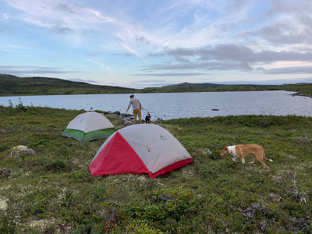
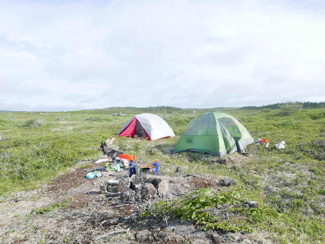
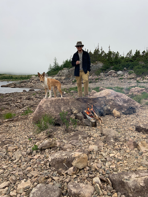
We set out around 10am and hiked around the south side of Madisons Rock. There was more bushwhacking through alders in this sections which was not exactly the route I had envisioned, and definitely added a couple clicks to the journey. The river and stream crossings dictated this path to us though. We still reached the western edge of Mobile Big Pond before noon, which was great timing. The water level was low and we found a section of beach with a ton of driftwood. Our original plan was to set up a camp and then hike Madisons Rock, but after yesterday’s walk we were gassed. I can’t overstate how difficult it was walking across bog for hours with a 40lb pack in the mid-20 degree heat. I totally underestimated it.
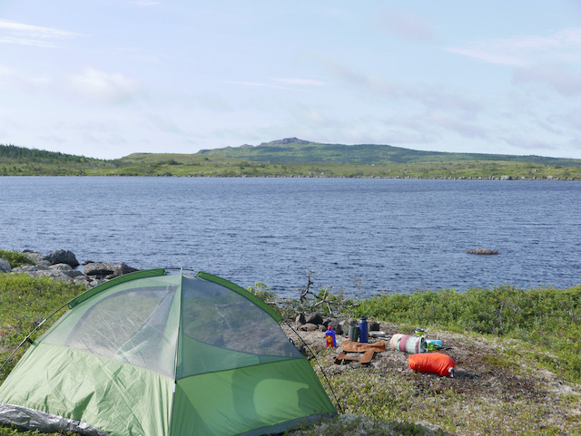
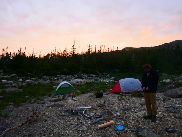
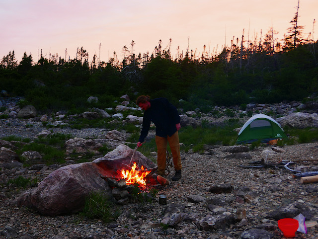
So we pitched our tents, got a glorious fire going and chilled all Saturday. I had a few flicks on the fishing rod but to no avail. Fortunately, we had brought more than enough grub so it was all good. This pond has a few cabins on it but has no road access to the west side and it was super quiet. With all the wood available on the beach our fire burned from noon all the way into the night with lots fuel left for the next day. Towards the end of the second day there was an amazing sunset (the photos below don’t do it justice) which was a nice way to cap off the relaxing afternoon.
The next day we had a quick breakfast and packed up around 9am to beat hiking in the full heat of the day. We figured it would take about four hours to get back to the car. We were mistaken.
We hooked into a quad trail leaving the lake so the going was good at first. I don’t know how exactly we got off course. I probably didn’t rely on the GPS as much as I did on the way in because I thought I knew where we were going. At any rate, we followed a very different route back to the car, which took us north for multiple kilometres past walls of impenetrable bush. The day was super hot and the flies and red ants were out. It was a rough end to the trip. We finally reached a pole line and followed it back for the last two kilometres.
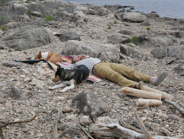
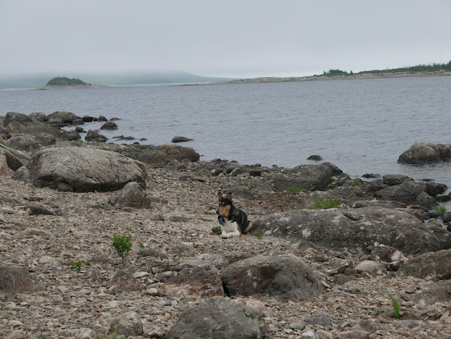
In the end, a 17km hike became more like 25km. I know that doesn’t sound too intense, but for our first attempt it was a lot. The dogs also got eaten alive by bugs, since they were lower to the bog and more vulnerable. I probably wouldn’t recommend taking mans best friend unless they’re use to that sort of thing. Anyways, despite the rough end, I had a huge sense of accomplishment for navigating this trek. I learned a lot about myself and about the woods and I’m stoked to attempt another hike like this one in the future.